What does WherobotsDB let me do today?
WherobotsDB unlocks extensive amounts of advantages in geospatial development.Specifically, WherobotsDB is:
- Modern, performant, and affordable. - Run small to planetary scale geospatial queries and jobs up to 20x faster, at a fraction of the cost versus other cloud analytics engines. Only pay for what you use.
- A unified solution for geospatial data - Derive insights through spatial relationships between vector and raster data types, eliminating the hurdle of toggling between single purpose systems and data type silos.
- Apache Sedona compatible - WherobotsDB’s open source foundation enables you to lift-and-shift Apache Sedona workloads into Wherobots with confidence, retaining the ability to run these workloads elsewhere if your needs change.
- Designed to leverage existing coding expertise - WherobotsDB supports popular development languages like Spatial SQL, Python, Java/Scala. This eliminates the need for your team’s engineers to become experts in esoteric coding languages.
- Built to avoid vendor lock-in - WherobotsDB supports open data formats like Parquet and GeoParquet, utilizes Apache Iceberg, and integrates with your cloud storage. This design ensures that your data remains accessible and portable, not confined to a single vendor’s ecosystem.
- Feature complete - Wherobots provides a comprehensive suite of tools for geospatial innovation. This includes notebooks for Exploratory Data Analysis (EDA), production-ready jobs for geospatial workloads, 300+ vector and raster functions, a catalog of popular geospatial datasets, and purpose-built solutions for tasks like computer vision, map matching, and vector tiling.
- Serverless, secure, and highly available - With WherobotsDB, you can offload the burden of managing infrastructure and indexing, freeing you to focus on deriving insights from your data. With a 99.5% runtime availability SLA and an architecture based around isolation, Wherobots strives to be secure by default.
WherobotsDB use cases
The following are common use cases for WherobotsDB:- Automating Spatial Data Processing - WherobotsDB uses Job Runs to schedule and automate data processing workloads. WherobotsDB integrates with Apache Airflow, allowing users to orchestrate their spatial ETL (Extract, Transform, Load) pipelines and leverage WherobotsDB’s immense performance strides to build production-ready geospatial workloads for vector and raster data.
- Modernizing Apache Spark + Apache Sedona Workloads - Apache Spark is designed to be a general purpose processing framework, not a framework optimized for processing geospatial data. Even with Apache Sedona’s geospatial extensions for Spark, the burden of cluster management, performance optimization, and indexing still falls on the user. WherobotsDB does this all for you, and more. If you’re already running Sedona on Spark, you can lift-and-shift those workloads into WherobotsDB and see the performance, productivity, and savings gains yourself.
- Extracting insights from aerial imagery - Gain deeper insights from your satellite imagery. WherobotsAI Raster Inference seamlessly integrates with WherobotsDB, letting you orchestrate your raster ETL workflows or interact with your results in a live notebook.
Get Started
Beginner: Create an account and start an example notebook
Account creation
If you are new to Wherobots or geospatial data analysis, create an account and run one of Wherobots’ example notebooks. The best way to get introduced to Wherobots is to run one of our example notebooks. Runningexamples/Getting_Started/Part_1_Loading_Data.ipynb will introduce some basic concepts of working with spatial data in WherobotsDB including:
- Introducing the Wherobots Data Catalogs
- Querying data with Spatial SQL
- Creating geospatial visualizations in the Wherobots Cloud notebook environment
Start a notebook
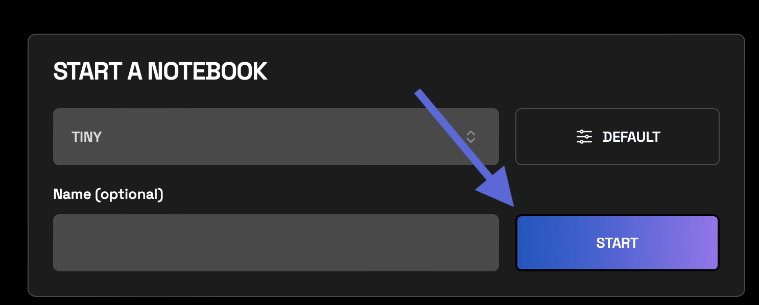
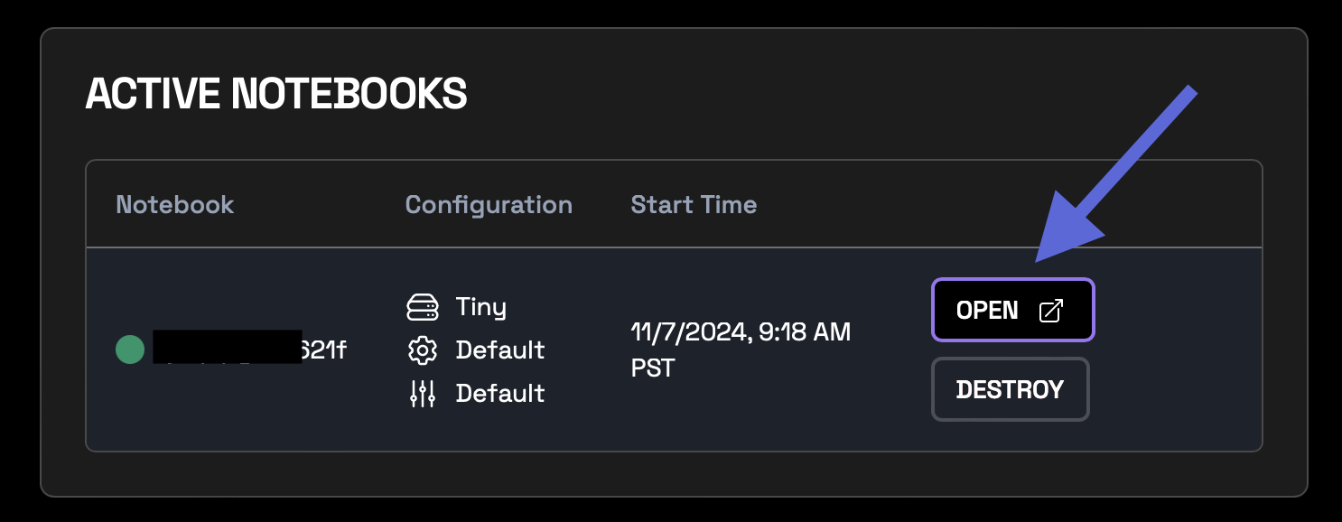
After you create an account, do the following:- Login to Wherobots Cloud and go to Notebooks.
- Click Start to initiate the runtime.

- Click Open to start
examples/Getting_Started/Part_1_Loading_Data.ipynb.
Advanced: Create a Job Run
If you already have geospatial workloads that you want to migrate to Wherobots, create a Job Run usingWherobotsRunOperator to incorporate Wherobots’ geospatial data processing features into your Airflow workflows.

